The places you mean to go one day, and what they looked like at half past three
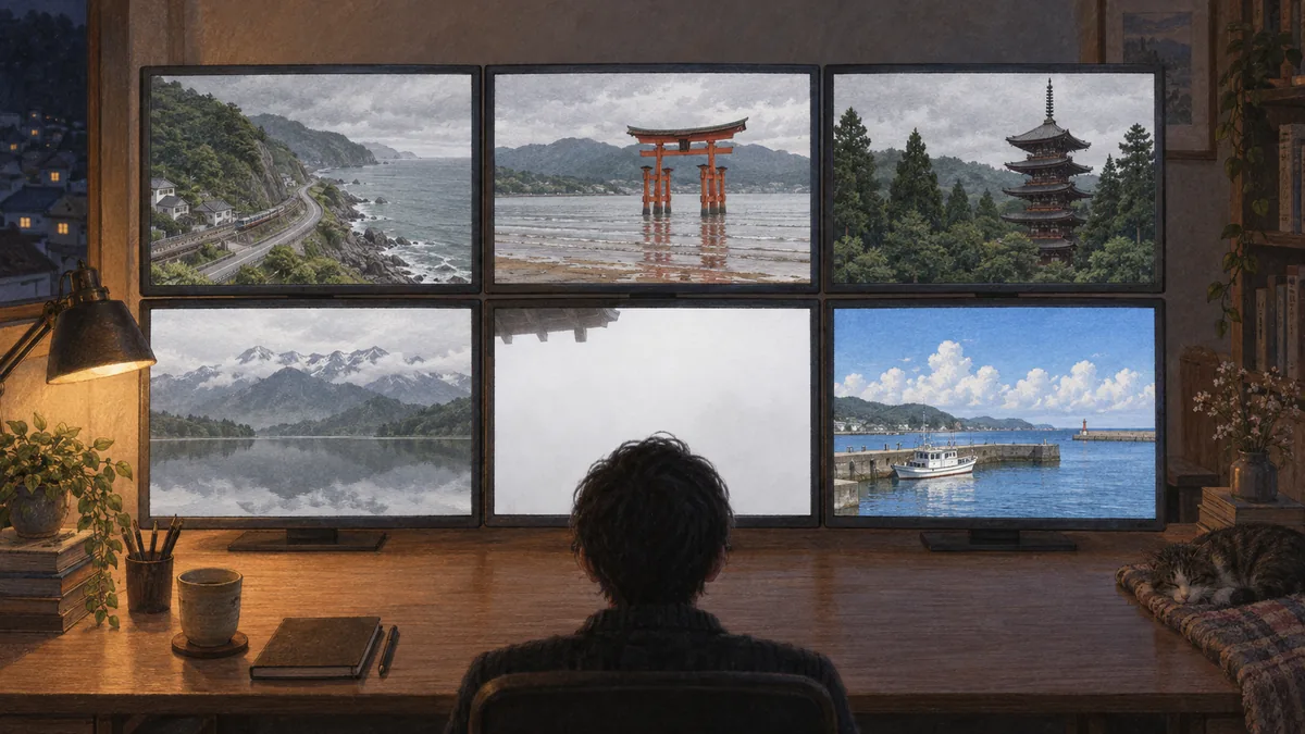
I opened six cameras in seventy seconds. Four were under cloud, one was inside it, and the furthest was in full sun. Here is what each place says about itself, and when its own calendar says to come.
Night Desk (LiveTokyo) / cameras watched at 15:31–15:32 JST on 8 September 2026 / published 8 September 2026
Between 15:31:14 and 15:32:25 on 8 September 2026 I opened six of this site's cameras, one after another, and looked at what each of them was showing. Four of the six were under cloud. One was inside the cloud. The last one, the furthest away, was in full sun with fair-weather cumulus stacked over the harbour. Seventy seconds, one country, two entirely different afternoons.
That is the useful thing about a page of live cameras, and it is not the thing people expect. A camera is not a photograph of a place at its best. It is the place on an ordinary Tuesday, at whatever hour it happens to be, in whatever weather turned up. If you are the kind of person who keeps a list of places in Japan you mean to get to one day, that ordinary version is worth more than the brochure, because it is the version you will actually meet.
So this is a walk through some of those someday places, using the cameras on this site. For each one I have written what the camera was showing when I looked, what the town or the shrine says about itself on its own pages, and what the official calendar says about when to come. Where the official page and my expectation disagreed, I have kept the official page.
Mount Fuji, which is frequently not there
I opened the Satta Pass camera first. Satta Pass is the point where the old Tokaido road is squeezed between a steep wooded slope and the sea at Yui, west along the coast from Shimizu. Shizuoka City runs the camera, and on its page about the city's attractions the description is one sentence: "歩きながら富士山を見る" is not what it says. What it says is that this is "the view Hiroshige drew in the woodblock print Yui, of the Fifty-three Stations of the Tokaido, streamed live on YouTube".
At 15:31:14 the print was there apart from its subject. The slope was on the left, the bay was grey-green on the right, and between them the coast road and the railway ran along the shoreline with traffic on both. Above the far headland, where the mountain belongs, there was cloud from one edge of the frame to the other. Hiroshige's composition, with the mountain deleted.
Thirty-nine seconds later I opened the Nihondaira camera, on the hill above Shizuoka city, and got something better. The frame was white. Not overexposed, not broken: the camera was inside the cloud, and the only things resolving were the wooden eaves of the observation walk at the top of the picture and a glass rail in the corner. The terrace is built from timber grown in the prefecture and it stands at about three hundred metres. On that afternoon it was in fog.
What I like about Nihondaira is that the building itself has already accepted this. Its own visitor page says that on the third floor "even when the weather means Mount Fuji cannot be seen, a large monitor displays beautiful footage of Mount Fuji". Somebody costed a screen, installed it, and wrote it into the guide, because a certain number of visitors were always going to arrive on a day like the one I was watching. That is a more honest description of Fuji-viewing than most travel writing manages.
Two practical notes for the terrace, both from its own site and both with dates on them. It is closed from 24 to 30 September 2026 for building work. From 1 October 2026 it stops being free: the notice reads "this facility, which you have been able to use free of charge, will charge an admission fee from Thursday 1 October 2026". Its own guide page still said "admission free" when I read it on 8 September, so take the newer notice.
If the plan is to climb it
The official climbing site is run jointly by the two prefectures the mountain sits in, and the 2026 season is short and specific. In English on its own page: "Yoshida Trail/Subashiri trail: July 1st to September 10th, 2026", and "Fujinomiya Trail, Gotemba Trail, and Summit (Crater Rim Trail): July 10th - September 10th, 2026". Which means that on the day I am writing this the season has two days left in it.
Both sides now charge and both sides gate. Yamanashi's notice, dated 17 April 2026, says the hiking fee is 4,000 yen per person per visit, that the fifth-station gate "will be closed from 2 PM to 3 AM the following day", and that it "will also be closed if the number of climbers per day reaches 4,000". Shizuoka's notice, dated 27 April 2026, sets the same 4,000 yen fee, requires you to finish an e-learning course before you go, requires a hut booking if you enter between 2 PM and 3 AM, and states plainly that "Shizuoka Prefecture has not set a daily limit on the number of climbers". Two prefectures, one mountain, two different rules about crowding. Read the side you are climbing.
If you want to see what the climb is before committing a summer to it, the travel YouTuber Suit has a single video of it: 富士山に1人で登ってみた! on the channel "スーツ 旅行 / Suit Travel". It runs just under three hours and covers the fifth station to the summit, the walk round the crater rim and the descent, in one piece. It is not a numbered series, which is worth saying because several unrelated channels using the same name have Fuji videos.
The same channel has the other thing, the one that connects to the Satta camera: a sixteen-part bicycle ride down the old Tokaido from Nihonbashi to Osaka, beginning with the first episode from January 2021. The fifth episode runs from Yoshiwara-juku to Fuchu-juku, and its chapter list in the description goes through Yui-juku and on to Okitsu-juku. Satta Pass lies between those two post towns, so the ride passes the camera. The video never names the pass, and I am not going to put a claim in its mouth.
The other Fuji cameras here are Lake Kawaguchi, Oshino Hakkai, Lake Ashi in Hakone and the Enoshima view. On a clear winter morning they show the mountain plainly. In September they are mostly a lesson in patience.
Kyoto in July, and the street that would rather you watched from here
The owner of this site suggested Gion Matsuri as the reason to pick a month for Kyoto, and that is right, with a wrinkle worth knowing before you book anything.
The festival is not an evening. Kyoto City Tourism Association's page gives the run as "1 July to 31 July", with the float processions on "17 July for the first half and 24 July for the second", and the yoiyama evenings before each on 14 to 16 and 21 to 23 July. Note what that page does not carry: a year. It is the recurring calendar, not a particular season's schedule. The one document that did give me a year was the Yasaka Shrine listing, and its heading reads "2021", which is old enough that I will not offer it as this year's timetable. Check the year's own page before you buy a ticket.
For what the procession actually looks like, the Kyoto Shimbun, the city's newspaper, has a video of the whole first-half procession, titled with the date 17 July 2026 and described as covering every float. A newspaper's own channel is a safer place to point at than a re-upload.
The part of Kyoto that is asking for something
Now the wrinkle. Alongside the festival pages, the city and the Gion district publish a set of requests to visitors, and they are unusually direct. The message from the south side of Gion, dated 5 December 2023, asks people not to "stop, touch, follow or photograph without permission the geiko and maiko who are walking", and adds a line that translates flatly and lands hard: "geiko and maiko are not mascot characters". The same page notes that blocking someone's path or following them carries a statutory penalty, and that pulling at a hand or clothing carries a heavier one under a local ordinance.
The same page asks visitors not to "wait on the pavement, stop to take photographs, or spill into the roadway", because "this is not a pedestrian street". Kiyomizu-dera's own answers page is similarly plain about cameras: no drones, no tripods or monopods, no wedding, cosplay or model shoots, and no filming for commercial purposes, which it spells out as including live streaming.
I am not repeating those to scold anybody, and the point is not that Kyoto is closed. The point is that a camera happens to be a good answer to the exact problem the district is describing. The view down Hanamikoji Street is on this site because the Kyoto City Tourism Association streams it. Watching that view costs the street nothing. So do the Kiyomizu-zaka slope, Fushimi Inari, the Arashiyama bamboo grove and the Togetsukyo bridge, the last two run by the association as part of how it publishes crowding levels. You can see how full the slope is before you decide what time to walk up it.
Miyajima, where the tide decides what you get
This one is new here. I added the Miyajima camera on 8 September 2026 while writing this piece, from the stream run by the Hiroshima commercial station HOME, and it earns its place because of a correction on the tourism association's own page.
Everybody arrives believing high tide equals the shrine afloat. The association says that is wrong, in a tone I did not expect from a tourism body: "the idea that high tide means the over-water shrine state is incorrect information. Correctly, the shrine becomes an over-water shrine when the tide level goes above 250 cm", and equally "the idea that low tide means you can walk to the great gate is incorrect information. Correctly, you can walk there when the tide level drops below 100 cm". The number that matters is the tide level in centimetres, not the word high or low, and the association publishes the day's figures.
At 15:31:29 the gate was standing on exposed flats. A pale band of sand ran from the gate back toward the shore, well clear of the water, with the shrine buildings on their piers to the right and the roofs of the town in the foreground. Under 100 cm, in other words, without my needing to guess.
Three things to budget for. Shrine admission for an adult is 300 yen on the shrine's own price table. Since 1 October 2023 there has also been a visitor tax, which Hatsukaichi City describes as a local tax on people coming to the island; JR West's ferry fare page states it as "on entering the island a Miyajima visitor tax of 100 yen is charged separately. Preschool children are exempt", and an annual payment is available instead. And the great gate's restoration, which hid it behind scaffolding for years, is finished: the shrine's works page says the repair ran from June 2019 and "was completed in December 2022".
The same works page also lists structural work on the east corridor and the five-storey pagoda with end dates in 2026 and 2027, while elsewhere on the page saying there is no work in progress, and it carries no update date. If a particular building matters to your visit, open the shrine's works page yourself before you go.
Nara's wooded hills, where the maples were still green
The sixth of the cameras I opened is the one I nearly left out of this piece, which would have been a mistake. Tanzan Shrine sits in the hills of Tonomine, south of Nara city, and I added it here on 8 September 2026 from the stream run by Nara Television.
At 15:31:57 the light was flat and bright under cloud. A wooden pagoda of stacked roofs stood among the trees on the right, with vermilion halls and a railed walkway below it, a rack of votive tablets and a stone lantern on the left, and a pale gravel path running between them. The maples filling the slope were still deep green.
That last detail is the whole point of the camera. The shrine's own page calls the thirteen-storey pagoda its symbol, and says of the grounds that "cherry and maple are abundant, and you can enjoy the beautiful mountain scenery of each season, cherry blossom in spring and autumn leaves in autumn". Which season you get is the entire question, and on 8 September the answer was still summer. If you are planning a trip around the colour, the camera will tell you where the slope has got to before you commit to a date.
The routes that are only open for part of the year
Some of the places people put on a someday list cannot be visited on a whim, because they are shut for months at a time. The Tateyama Kurobe Alpine Route, which the Murodo camera sits on, publishes its season on its top page: 15 April to 30 November for 2026. Outside that window the question of when to go does not arise.
Its best-known spring sight is the corridor cut through the snow at Murodo, walkable for a few weeks after the route opens. I am not going to give you a height for the wall. The page that carried the operator's own description of it has been taken down since my copy was saved, and the height is not a fixed thing anyway: the operator runs a competition each spring inviting people to guess how high the wall will be on opening day, which is a fair indication of how much it moves. Treat the corridor as a season, not a date, and take the season from the route's own top page.
Winter has the opposite problem and the same answer. Ouchi-juku, the thatched post town in Fukushima, holds a snow festival that the Aizu tourism site dates to 14 and 15 February 2026. Echizen-Ono Castle is the one that appears above a sea of cloud, on mornings that cannot be booked in advance. Kenroku-en in Kanazawa is open year round and is the safest of the three to plan around.
North, and a lake with a statue that is two colours at once
Lake Tazawa is the other camera I added while writing this. Semboku City, which runs the stream, describes the lake on its own page as "an almost perfectly circular lake about 20 kilometres around" whose depth of 423.4 metres "boasts the greatest in Japan". That is the city's claim about its own lake and I am passing it on as such.
You will also read that Lake Tazawa never freezes. It is on the city's pages, and it is worth knowing where it comes from before repeating it: the sentence sits inside the retelling of the Tatsuko legend, where a dragon spends each winter in the lake and so "the lake where the two dragon gods live is known as the lake that does not freeze through the winter". That is a folk tale being reported as a folk tale. It is not a meteorological observation, and I have not found one.
The statue at the shore is a nice small lesson in reading sources. Semboku City's page calls it "a bronze statue of the legendary beautiful girl Princess Tatsuko", made by Funakoshi Yasutake and erected in 1968. The camera, at 15:32:08, showed a figure that is plainly gold: a bright gilded woman on a plinth above a black railing, with a big drooping tree to the left and the lake flat as a mirror behind her. Bronze is what the city says it is made of. Gold is what it looks like. Both are true and they answer different questions.
The far south, which was having a different day
At 15:32:25, the last of the six, Ishigaki was in sunshine. Blue sky with fair-weather cumulus lined up across it, the harbour below with white boats and ferries along the piers, a blue arch bridge to the right, and open ocean past the breakwater. The mainland cameras had been grey for the previous seventy seconds. Ishigaki is the main island of the Yaeyama group and it is a long way south of everything else on this page, which is exactly what the frame showed.
The island's tourism association is currently recruiting for a course to train guides for the night sky, describing Ishigaki as sitting in an environment suited to observing and viewing the stars. If you are choosing a Japanese island for a specific reason, that is a more useful reason than most.
The other far-southern cameras here are the Bise coast on Okinawa's main island and the Yui Rail in Naha.
The pages that change, and are worth opening on the day
Four of the things above have a shelf life, and the honest way to end a piece like this is to say which ones and hand you the page.
The clearest case is Aso. Whether you can approach the crater is set by the volcanic advisory, and it moves. When I opened the Aso volcano regulation site on the afternoon of 8 September 2026 it said a crater-area warning at level 2 was in force and that entry within roughly 1 km of the crater was prohibited. Aso City's own page about the toll road and crater viewing said, with no update date on it, that the road was closed and crater viewing was therefore not possible for the time being. I am not going to adjudicate between two official pages. Open the Japan Meteorological Agency's Aso page and the regulation site on the morning you plan to go.
The Hiroshige connection at Satta has a similar catch. The Shizuoka City Tokaido Hiroshige Museum at Yui, which holds about 1,400 works and was the first museum in Japan named after the artist, is closed: its guide page says it is closed for refurbishment "from Monday 1 June 2026 until the end of March 2027". The pass is still there. The museum is not, this year.
And a small warning about one official site. The Gion Matsuri Yamahoko Association is the body that runs the floats, but its website's secure connection is broken: it serves a certificate issued to an unrelated domain which expired in 2016, so a browser will refuse it. The site answers over an unencrypted connection only. I have not linked it below. For the festival, use Yasaka Shrine and the city tourism association's pages, both of which are fine.
What I opened, and when
| Place | The camera here | What the official page says | When I read it |
|---|---|---|---|
| Mount Fuji, Satta Pass | Satta Pass | Shizuoka City: the view Hiroshige drew for Yui, streamed on YouTube | 8 Sep 2026, 15:31 |
| Mount Fuji, Nihondaira | Nihondaira | Closed 24–30 Sep 2026; admission charged from 1 Oct 2026 | 8 Sep 2026 |
| Mount Fuji, the climb | no camera | Yoshida and Subashiri 1 Jul–10 Sep 2026; Fujinomiya, Gotemba and the summit 10 Jul–10 Sep 2026; fee 4,000 yen per person per visit | notices dated 17 and 27 Apr 2026 |
| Kyoto, Gion Matsuri | Hanamikoji | 1–31 July; processions 17 and 24 July (no year given on the page) | 8 Sep 2026 |
| Kyoto, Gion district | Hanamikoji | Do not stop, touch, follow or photograph geiko and maiko without permission | page dated 5 Dec 2023 |
| Miyajima | Itsukushima | Over-water above 250 cm tide level; walkable below 100 cm; visitor tax 100 yen per entry | 8 Sep 2026, 15:31 |
| Tateyama Murodo | Murodo | 2026 season 15 Apr–30 Nov | 8 Sep 2026 |
| Tanzan Shrine, Nara | Tanzan Shrine | The shrine: cherry and maple are abundant, cherry blossom in spring and autumn leaves in autumn | 8 Sep 2026, 15:31 |
| Lake Tazawa | Lake Tazawa | Semboku City: depth 423.4 m, described as the greatest in Japan | 8 Sep 2026, 15:32 |
| Ishigaki | Ishigaki | Tourism association trains night-sky guides | 8 Sep 2026, 15:32 |
| Aso | Aso Nakadake | Level 2 crater-area warning, entry within about 1 km prohibited; city page says the toll road is closed | 8 Sep 2026, afternoon |
Fees and opening periods are as the pages read on the dates in the last column. They change. The camera pages on this site are the live part; the official pages are the part to check.
There is one more thing the six frames taught me, and it is the reason this site exists in the shape it does. A place on a someday list is not waiting for you in the condition of its photographs. Satta Pass had no mountain in it. Nihondaira was inside a cloud, in a building that owns a screen for precisely that. Miyajima's gate was standing on sand. Ishigaki was in the sun, eighteen hundred kilometres from the rest of it. All of that was true at the same minute of the same ordinary Tuesday afternoon, and you can go and check whether it still is.
If you only open one, make it Nihondaira, and see whether the cloud has lifted off it yet.